Maps & Local Resources
Click on any map below for a larger view.
WORD District Map
The boundaries of the Water Oriented Recreation District of Comal County.
Guadalupe River Map
This map shows trout fishing information for the lower Guadalupe River between the Canyon Lake dam and the City of New Braunfels.
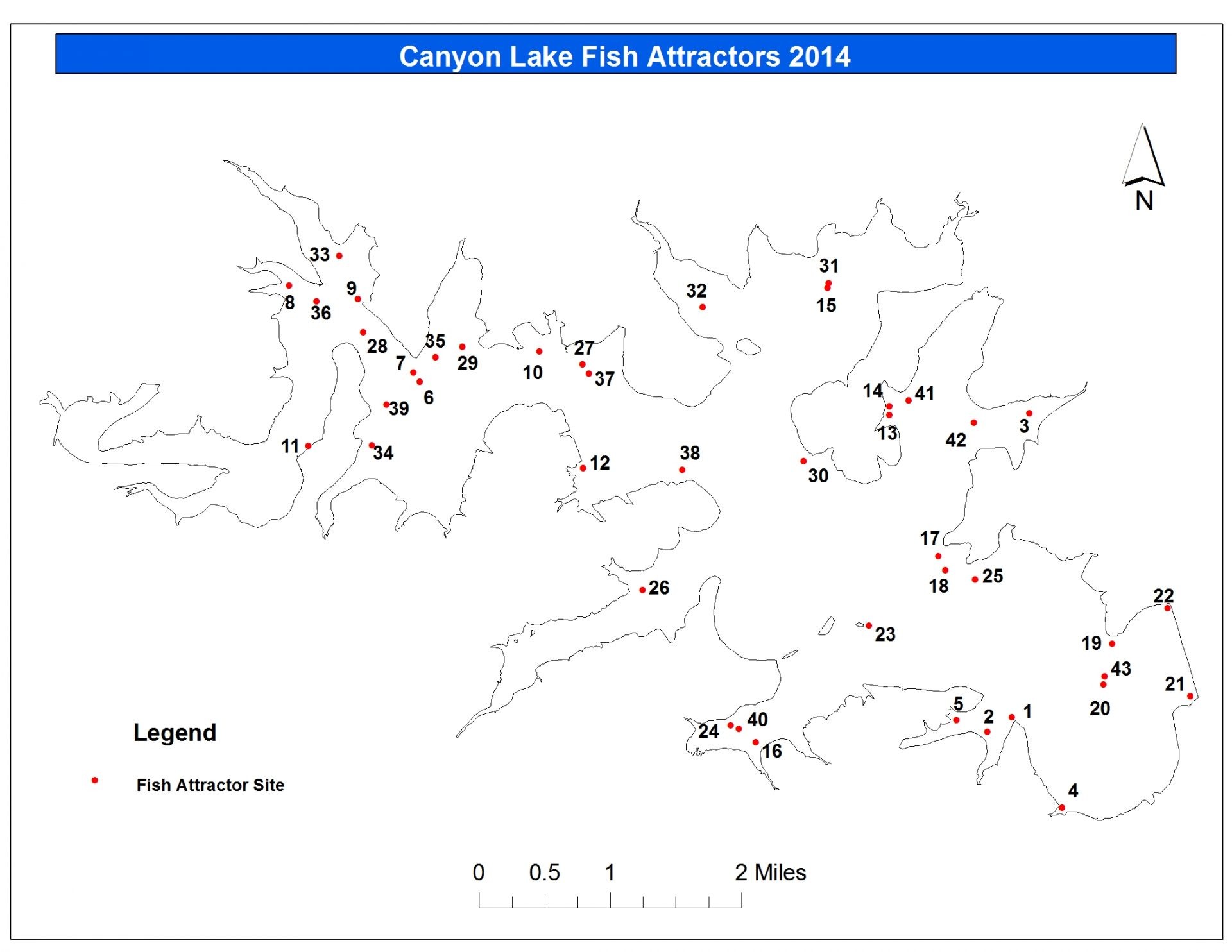
Canyon Lake Fish Attractors Map
This map shows the general locations where Texas Parks and Wildlife has placed fish attractors in Canyon Lake.
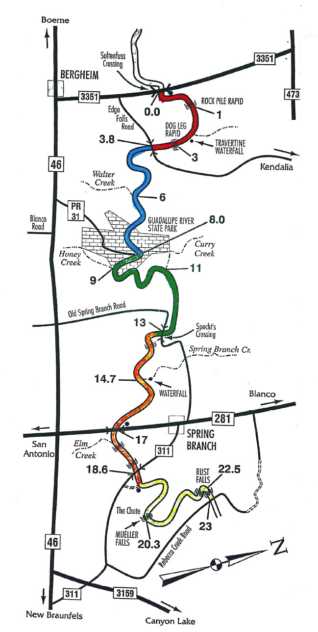
Upper Guadalupe River Map
The Guadalupe River above Canyon Lake has a primitive and beautiful scenery. From 0.0 to 8.0 you will float outside the WORD District. Mile 8 begins at the Guadalupe State Park.
County Map
For more maps and information about Comal County visit the county’s GIS link at cceo.org.
Boat Ramp Map
Click image for a printable map to all Canyon Lake boat-ramp locations.
Alternate Routes Map
This maps shows alternate routes to the District during peak hours. Use this map to avoid heavily trafficked areas.
Canyon Lake Buoy Placement
Informational buoys numbered 1 through 12 run an approximate center line from Canyon Dam to the west of Cranes Mill Park.
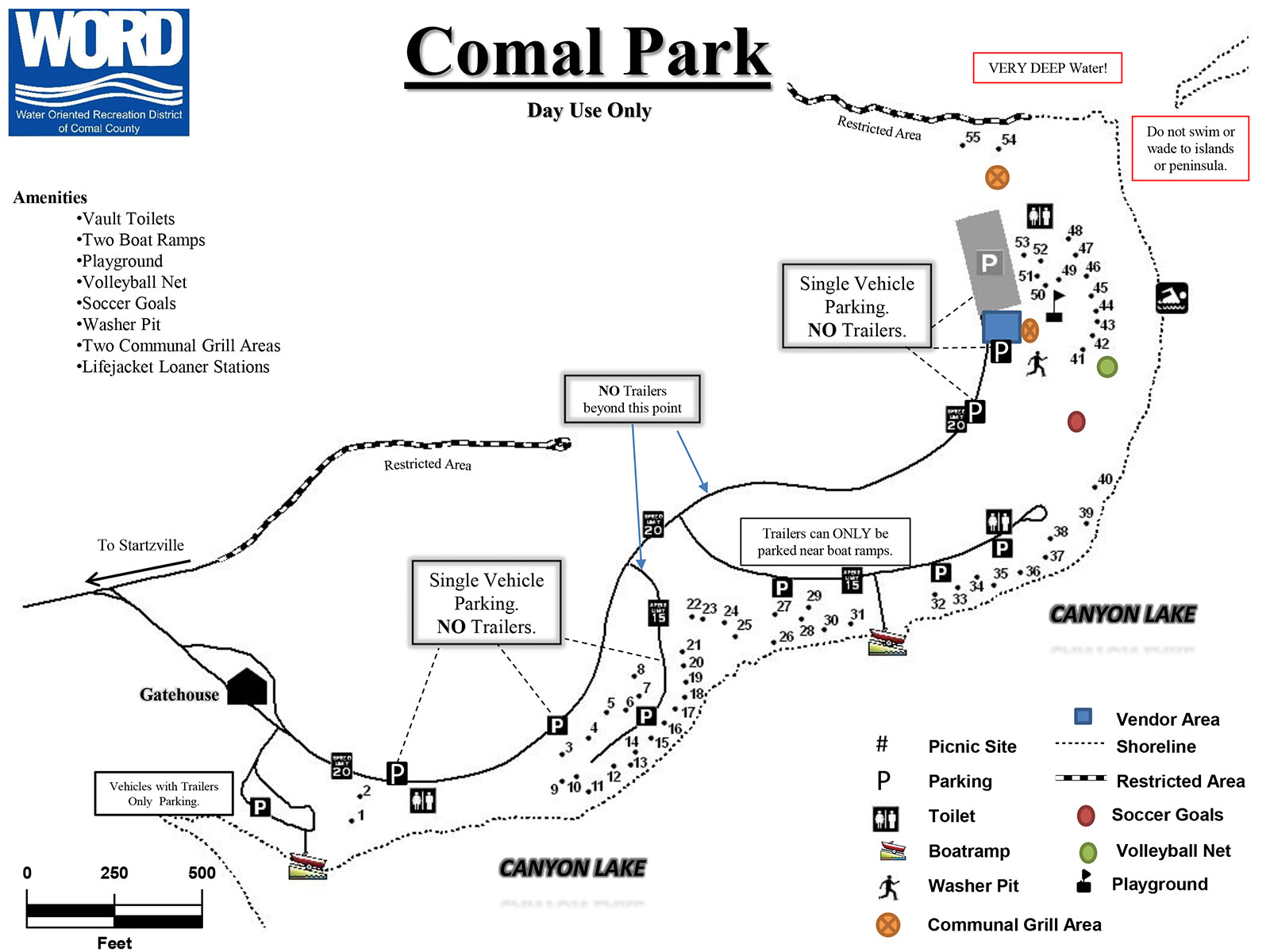
Comal Park
WORD-operated Comal Park is located on the south side of the lake in Startzville. For more info about Canyon Lake parks visit the U.S. Army Corps of Engineers website.
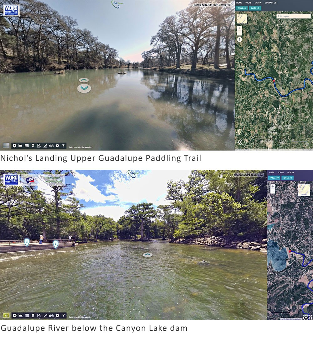
Virtual Guadalupe River Map
Take a trip on the Guadalupe River before you float it with our virtual river tours. For more information visit our Guadalupe River tab under the Plan Your Trip tab.
Local Resources
Comal County Commissioners Court | 830-221-1100
Comal County Sheriff’s Office
| Non-Emergency Phone: 830-620-3400
Guadalupe Blanco River Authority | 830-964-5424
Texas Parks and Wildlife
| (512) 389-4800
United States Army Corps of Engineers | Local Office Phone: 830-964-3341
Canyon Lake Chamber of Commerce | 800-528-2104
Greater New Braunfels Chamber of Commerce | 800-572-2626
Edwards Aquifer Authority
| (210) 222-2204
Lower Colorado River Authority
| (512) 473-3216


